
COURSE OVERVIEW
DE1074-3D : Seeing from Above: Remote Sensing & Photogrammetry
OVERVIEW
| COURSE TITLE | : | DE1074-3D : Seeing from Above: Remote Sensing & Photogrammetry |
| COURSE DATE | : | Aug 10 - Aug 12 2026 |
| DURATION | : | 3 Days |
| INSTRUCTOR | : | Dr. Nawras Shatnawi |
| VENUE | : | Virtual Course |
| COURSE FEE | : | $ 2625 |
Course Description
This practical and highly-interactive course includes various practical sessions and exercises. Theory learnt will be applied using our state-of-the-art simulators.
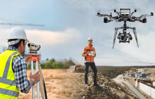
This course is designed to provide participants with a detailed and up-to-date overview of Seeing from Above: Remote Sensing and Photogrammetry. It covers the basic concepts of remote sensing, electromagnetic spectrum basics and remote sensing platforms; the sensors and data types, image acquisition principles and image interpretation; the photogrammetry, principles of image geometry and aerial photography concepts; the importance of ground control points (GCPs) as well as 3D mapping and modelling; and the drone mapping covering UAV basics and components, flight planning for mapping, data capture workflow and safety and regulations.
During this interactive course, participants will learn the image processing basics covering pre-processing steps, radiometric and geometric correction, noise removal techniques and image enhancement methods; the GIS integration by linking remote sensing with GIS, data layering and visualization and coordinating systems and projections; the land cover classification basics, training data selection and accuracy assessment; the concept of temporal analysis, methods for detecting change and applications in environmental monitoring; and the pipeline route monitoring, environmental impact assessment, infrastructure mapping and asset inspection using remote sensing.
link to course overview PDF
This course is designed to provide participants with a detailed and up-to-date overview of Seeing from Above: Remote Sensing and Photogrammetry. It covers the basic concepts of remote sensing, electromagnetic spectrum basics and remote sensing platforms; the sensors and data types, image acquisition principles and image interpretation; the photogrammetry, principles of image geometry and aerial photography concepts; the importance of ground control points (GCPs) as well as 3D mapping and modelling; and the drone mapping covering UAV basics and components, flight planning for mapping, data capture workflow and safety and regulations.
During this interactive course, participants will learn the image processing basics covering pre-processing steps, radiometric and geometric correction, noise removal techniques and image enhancement methods; the GIS integration by linking remote sensing with GIS, data layering and visualization and coordinating systems and projections; the land cover classification basics, training data selection and accuracy assessment; the concept of temporal analysis, methods for detecting change and applications in environmental monitoring; and the pipeline route monitoring, environmental impact assessment, infrastructure mapping and asset inspection using remote sensing.
TRAINING METHODOLOGY
This interactive training course includes the following training methodologies:
LecturesPractical Workshops & Work Presentations
Hands-on Practical Exercises & Case Studies
Simulators (Hardware & Software) & Videos
In an unlikely event, the course instructor may modify the above training methodology for technical reasons.
VIRTUAL TRAINING (IF APPLICABLE)
If this course is delivered online as a Virtual Training, the following limitations will be applicable:
| Certificates | : | Only soft copy certificates will be issued |
| Training Materials | : | Only soft copy materials will be issued |
| Training Methodology | : | 80% theory, 20% practical |
| Training Program | : | 4 hours per day, from 09:30 to 13:30 |
RELATED COURSES
DE0448 : Drilling Problems and Drilling Optimization
- Date: Oct 04 - Oct 08 / 3 Days
- Location: Doha, Qatar
- Course Details Register
DE0900 : Completion Design Practices and Perforation
- Date: Oct 04 - Oct 08 / 3 Days
- Location: Doha, Qatar
- Course Details Register

DE0797 : Correlation Methods
- Date: Oct 04 - Oct 08 / 3 Days
- Location: Doha, Qatar
- Course Details Register

DE0419 : Completion Equipment
- Date: Oct 04 - Oct 08 / 3 Days
- Location: Doha, Qatar
- Course Details Register