COURSE OVERVIEW
DE0004 : Geomatics Applications in Environmental Assessment
OVERVIEW
| COURSE TITLE | : | DE0004 : Geomatics Applications in Environmental Assessment |
| COURSE DATE | : | Jan 06 - Jan 10 2025 |
| DURATION | : | 5 Days |
| INSTRUCTOR | : | Mr. Saber Hussein |
| VENUE | : | Abu Dhabi, UAE |
| COURSE FEE | : | $ 8000 |
| Request For Course Outline | ||
Course Description
This hands-on, highly-interactive course includes practical sessions and exercises. Theory learnt will be applied using our state-of-the-art simulator.
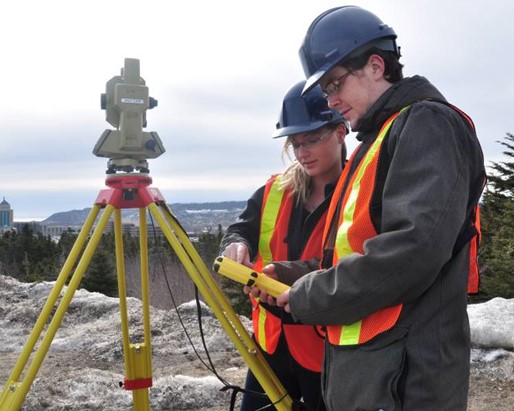
Geomatics, geodesy and cartography play an important role in surveying and mapping engineering. Geodetic datums refer to the reference surfaces, reference points, and their relevant parameters in surveying and mapping, including coordinate datums, vertical datums, sounding datums, and gravity datums. They are the reference surfaces or points against which measurements are made and they provide the basis for establishing geodetic systems. Geodetic systems are the extension of different types of datums realized through establishment of the nationwide geodetic control networks, which include the geodetic coordinate system, plane coordinate system, height system, and gravimetric system.
Use of incorrect geodetic parameters can cause major errors in positions of wells, pipelines, and seismic surveys, with significant financial losses and sometimes with HSE risks, as demonstrated by case studies. Awareness of geodetic datums, coordinate reference systems, and map projections is provided via interactive demonstrations and hands-on workshop exercises using the online EPSG Geodetic Registry. Students learn how Global Navigation Satellite Systems (GNSS) including GPS work.
link to course overview PDF
TRAINING METHODOLOGY
This interactive training course includes the following training methodologies:
LecturesPractical Workshops & Work Presentations
Hands-on Practical Exercises & Case Studies
Simulators (Hardware & Software) & Videos
In an unlikely event, the course instructor may modify the above training methodology for technical reasons.
VIRTUAL TRAINING (IF APPLICABLE)
If this course is delivered online as a Virtual Training, the following limitations will be applicable:
| Certificates | : | Only soft copy certificates will be issued |
| Training Materials | : | Only soft copy materials will be issued |
| Training Methodology | : | 80% theory, 20% practical |
| Training Program | : | 4 hours per day, from 09:30 to 13:30 |
This course is no longer available.
Please check below for other scheduled dates.
RELATED COURSES
DE0250 : Subsurface Production Operations
- Date: Jul 27 - Jul 31 / 3 Days
- Location: London, United Kingdom
- Course Details Register

DE0794 : Well Abandonment - Plug, Abandonment and Decommissioning
- Date: Jul 27 - Jul 31 / 3 Days
- Location: London, United Kingdom
- Course Details Register

DE0379 : Fracturing of Vertical and Horizontal Wells
- Date: Jul 27 - Jul 31 / 3 Days
- Location: Seville, Spain
- Course Details Register
DE0266 : Applied Field Development Planning
- Date: Jul 27 - Jul 31 / 3 Days
- Location: London, United Kingdom
- Course Details Register